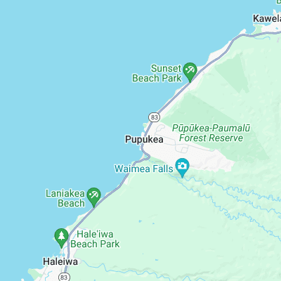
Rubber Duckies (Avocado Beach) Surf Report
| Wave height * | 2.5ft / 0.7m |
|---|---|
| Swell period | 12s |
| Swell direction | |
| Wind | |
| Sea temp | 24°C / 76°F |
10 day Rubber Duckies surf forecast
Sun
12/May
2.5ft
9
11
11
- Low 2:22am
- High 8:17am
- Low 10:33am
- High 8:00pm
Mon
13/May
4.5ft
10
12
11
- Low 3:11am
- High 10:02am
- Low 12:02pm
- High 8:58pm
Tue
14/May
4ft
8
2
1
- Low 3:46am
- High 11:04am
- Low 1:51pm
- High 9:50pm
Wed
15/May
4ft
4
17
13
- Low 4:13am
- High 11:45am
- Low 3:25pm
- High 10:36pm
Thu
16/May
5.5ft
3
8
2
- Low 4:34am
- High 12:18pm
- Low 4:40pm
- High 11:16pm
Fri
17/May
5.5ft
5
7
7
- Low 4:53am
- High 12:49pm
- Low 5:43pm
- High 11:52pm
Sat
18/May
5.5ft
8
14
14
- Low 5:12am
- High 1:18pm
- Low 6:39pm
Sun
19/May
4ft
11
11
11
- High 12:27am
- Low 5:32am
- High 1:48pm
- Low 7:29pm
Mon
20/May
3ft
7
10
12
- High 1:01am
- Low 5:54am
- High 2:19pm
- Low 8:16pm
Sun 12th May
| 5:00 | 2.5ft | 5.2ft | 12s | 6mph (7mph) | |||
| 8:00 | 2.5ft | 5.2ft | 10s | 9mph (10mph) | |||
| 11:00 | 3ft | 5.2ft | 8s | 12mph (12mph) | |||
| 14:00 | 2.5ft | 5.1ft | 9s | 11mph (11mph) | |||
| 17:00 | 2.5ft | 5ft | 11s | 11mph (11mph) | |||
| 20:00 | 2.5ft | 4.9ft | 11s | 11mph (15mph) |
| Tide times |
|---|
| Low 2:22am (0.04m) |
| High 8:17am (0.26m) |
| Low 10:33am (0.19m) |
| High 8:00pm (1.40m) |
| Daylight | |
|---|---|
| First light | 05:30 |
| Sunrise | 05:54 |
| Sunset | 19:02 |
| Dark | 19:26 |
Mon 13th May
| 5:00 | 4ft | 5.6ft | 15s | 10mph (12mph) | |||
| 8:00 | 4.5ft | 5.9ft | 14s | 10mph (11mph) | |||
| 11:00 | 4.5ft | 5.8ft | 14s | 15mph (14mph) | |||
| 14:00 | 4.5ft | 5.7ft | 13s | 12mph (10mph) | |||
| 17:00 | 4ft | 5.6ft | 13s | 11mph (10mph) | |||
| 20:00 | 4ft | 5.5ft | 13s | 11mph (12mph) |
| Tide times |
|---|
| Low 3:11am (0.03m) |
| High 10:02am (0.39m) |
| Low 12:02pm (0.33m) |
| High 8:58pm (1.29m) |
| Daylight | |
|---|---|
| First light | 05:30 |
| Sunrise | 05:53 |
| Sunset | 19:03 |
| Dark | 19:27 |
Tue 14th May
| 5:00 | 4ft | 5.4ft | 12s | 9mph (10mph) | |||
| 8:00 | 4ft | 5.3ft | 12s | 8mph (9mph) | |||
| 11:00 | 4ft | 5.2ft | 12s | 5mph (4mph) | |||
| 14:00 | 4ft | 5.1ft | 12s | 2mph (2mph) | |||
| 17:00 | 4ft | 5ft | 12s | 2mph (2mph) | |||
| 20:00 | 4ft | 4.9ft | 16s | 1mph (1mph) |
| Tide times |
|---|
| Low 3:46am (0.01m) |
| High 11:04am (0.56m) |
| Low 1:51pm (0.42m) |
| High 9:50pm (1.20m) |
| Daylight | |
|---|---|
| First light | 05:29 |
| Sunrise | 05:53 |
| Sunset | 19:03 |
| Dark | 19:27 |
Wed 15th May
| 5:00 | 4ft | 4.9ft | 14s | 6mph (7mph) | |||
| 8:00 | 4ft | 4.8ft | 15s | 4mph (7mph) | |||
| 11:00 | 4ft | 4.9ft | 17s | 8mph (12mph) | |||
| 14:00 | 4ft | 5ft | 17s | 17mph (19mph) | |||
| 17:00 | 4ft | 5ft | 15s | 16mph (20mph) | |||
| 20:00 | 4ft | 4.8ft | 16s | 13mph (17mph) |
| Tide times |
|---|
| Low 4:13am (-0.01m) |
| High 11:45am (0.75m) |
| Low 3:25pm (0.45m) |
| High 10:36pm (1.11m) |
| Daylight | |
|---|---|
| First light | 05:29 |
| Sunrise | 05:53 |
| Sunset | 19:04 |
| Dark | 19:28 |
Thu 16th May
| 5:00 | 5.5ft | 6.8ft | 16s | 5mph (5mph) | |||
| 8:00 | 5.5ft | 7.5ft | 11s | 3mph (3mph) | |||
| 11:00 | 5.5ft | 7.4ft | 10s | 8mph (6mph) | |||
| 14:00 | 5.5ft | 7.1ft | 11s | 8mph (8mph) | |||
| 17:00 | 5.5ft | 7ft | 14s | 1mph (3mph) | |||
| 20:00 | 5.5ft | 7.1ft | 14s | 2mph (3mph) |
| Tide times |
|---|
| Low 4:34am (-0.03m) |
| High 12:18pm (0.96m) |
| Low 4:40pm (0.44m) |
| High 11:16pm (1.00m) |
| Daylight | |
|---|---|
| First light | 05:28 |
| Sunrise | 05:52 |
| Sunset | 19:04 |
| Dark | 19:28 |
Fri 17th May
| 5:00 | 5ft | 7.4ft | 11s | 3mph (2mph) | |||
| 8:00 | 5ft | 7.5ft | 11s | 5mph (6mph) | |||
| 11:00 | 5.5ft | 7.8ft | 12s | 2mph (7mph) | |||
| 14:00 | 5.5ft | 8ft | 12s | 7mph (11mph) | |||
| 17:00 | 5.5ft | 7.7ft | 12s | 8mph (12mph) | |||
| 20:00 | 5.5ft | 7.4ft | 12s | 7mph (9mph) |
| Tide times |
|---|
| Low 4:53am (-0.06m) |
| High 12:49pm (1.16m) |
| Low 5:43pm (0.41m) |
| High 11:52pm (0.89m) |
| Daylight | |
|---|---|
| First light | 05:28 |
| Sunrise | 05:52 |
| Sunset | 19:05 |
| Dark | 19:29 |
Sat 18th May
| 5:00 | 5ft | 6.4ft | 14s | 8mph (12mph) | |||
| 8:00 | 4.5ft | 6.3ft | 14s | 8mph (16mph) | |||
| 11:00 | 5ft | 6.6ft | 14s | 10mph (15mph) | |||
| 14:00 | 5.5ft | 6.6ft | 15s | 14mph (16mph) | |||
| 17:00 | 5ft | 6.3ft | 14s | 13mph (15mph) | |||
| 20:00 | 5ft | 6.6ft | 17s | 14mph (19mph) |
| Tide times |
|---|
| Low 5:12am (-0.10m) |
| High 1:18pm (1.36m) |
| Low 6:39pm (0.35m) |
| Daylight | |
|---|---|
| First light | 05:27 |
| Sunrise | 05:51 |
| Sunset | 19:05 |
| Dark | 19:29 |
Sun 19th May
| 5:00 | 4ft | 6.1ft | 15s | 10mph (13mph) | |||
| 8:00 | 4.5ft | 6.2ft | 15s | 11mph (16mph) | |||
| 11:00 | 4ft | 6.2ft | 15s | 7mph (9mph) | |||
| 14:00 | 4ft | 5.9ft | 15s | 11mph (15mph) | |||
| 17:00 | 3.5ft | 5.6ft | 14s | 13mph (14mph) | |||
| 20:00 | 3.5ft | 5.5ft | 14s | 11mph (13mph) |
| Tide times |
|---|
| High 12:27am (0.78m) |
| Low 5:32am (-0.14m) |
| High 1:48pm (1.53m) |
| Low 7:29pm (0.29m) |
| Daylight | |
|---|---|
| First light | 05:27 |
| Sunrise | 05:51 |
| Sunset | 19:05 |
| Dark | 19:30 |
Mon 20th May
| 5:00 | 3.5ft | 5.3ft | 13s | 5mph (7mph) | |||
| 8:00 | 3.5ft | 5.2ft | 13s | 7mph (8mph) | |||
| 11:00 | 3ft | 4.9ft | 13s | 10mph (11mph) | |||
| 14:00 | 3ft | 4.8ft | 13s | 10mph (10mph) | |||
| 17:00 | 3ft | 4.7ft | 12s | 9mph (9mph) | |||
| 20:00 | 2.5ft | 4.6ft | 12s | 12mph (12mph) |
| Tide times |
|---|
| High 1:01am (0.67m) |
| Low 5:54am (-0.18m) |
| High 2:19pm (1.66m) |
| Low 8:16pm (0.23m) |
| Daylight | |
|---|---|
| First light | 05:27 |
| Sunrise | 05:51 |
| Sunset | 19:06 |
| Dark | 19:30 |
Tue 21st May
| 5:00 | 2ft | 4.3ft | 12s | 11mph (11mph) | |||
| 8:00 | 1.5ft | 4.2ft | 12s | 12mph (12mph) | |||
| 11:00 | 1.5ft | 4.2ft | 12s | 8mph (7mph) | |||
| 14:00 | 1.5ft | 4.2ft | 12s | 10mph (9mph) |
| Tide times |
|---|
| High 1:37am (0.56m) |
| Low 6:19am (-0.21m) |
| High 2:52pm (1.75m) |
| Daylight | |
|---|---|
| First light | 05:26 |
| Sunrise | 05:50 |
| Sunset | 19:06 |
| Dark | 19:31 |
Nearest buoys
Fairly uninspiring, right-hander breaking over sharp rocks
Surf spots nearby
- Pinballs (0.3 mi)
- Waimea Bay (0.3 mi)
- Log Cabins (0.4 mi)
- Off The Wall (0.8 mi)
- Uppers (1 mi)
- Outside Log Cabins (1.1 mi)
- Rockpile (1.1 mi)
- Alligator Rock (1.4 mi)
- Backdoor (1.4 mi)
- Leftover's (1.5 mi)
Not Magic Seaweed (MSW)
Although we look a bit like Magic Seaweed we are not MagicSeaweed as they no longer exist...