Gyllyngvase Surf Report
| Wave height * | 0.5ft / 0.1m |
|---|---|
| Swell period | 9s |
| Swell direction | |
| Wind | |
| Sea temp | 13°C / 56°F |
10 day Gyllyngvase surf forecast
Sun
19/May
0.5ft
5
8
2
- High 3:27am
- Low 10:07am
- High 3:50pm
- Low 10:23pm
Mon
20/May
0.5ft
6
9
2
- High 4:05am
- Low 10:45am
- High 4:26pm
- Low 11:01pm
Tue
21/May
0.5ft
4
2
8
- High 4:40am
- Low 11:21am
- High 5:01pm
- Low 11:38pm
Wed
22/May
0.5ft
9
14
13
- High 5:16am
- Low 11:57am
- High 5:35pm
Thu
23/May
0.5ft
5
8
12
- Low 12:15am
- High 5:51am
- Low 12:33pm
- High 6:11pm
Fri
24/May
1ft
4
5
6
- Low 12:53am
- High 6:27am
- Low 1:11pm
- High 6:48pm
Sat
25/May
1.5ft
15
20
18
- Low 1:33am
- High 7:06am
- Low 1:50pm
- High 7:28pm
Sun
26/May
2ft
11
16
8
- Low 2:14am
- High 7:48am
- Low 2:31pm
- High 8:11pm
Mon
27/May
0.5ft
8
5
12
- Low 2:59am
- High 8:35am
- Low 3:17pm
- High 9:01pm
Tue
28/May
0.5ft
9
12
9
- Low 3:49am
- High 9:29am
Sun 19th May
| 4:00 | 0.5ft | 2.1ft | 10s | 6mph (6mph) | |||
| 7:00 | 0.5ft | 2ft | 10s | 5mph (10mph) | |||
| 10:00 | 0.5ft | 2ft | 10s | 7mph (11mph) | |||
| 13:00 | 0.5ft | 2ft | 10s | 8mph (11mph) | |||
| 16:00 | 0.5ft | 2ft | 10s | 6mph (12mph) | |||
| 19:00 | 0.5ft | 2.1ft | 10s | 2mph (4mph) |
| Tide times |
|---|
| High 3:27am (4.72m) |
| Low 10:07am (1.46m) |
| High 3:50pm (4.75m) |
| Low 10:23pm (1.50m) |
| Daylight | |
|---|---|
| First light | 04:45 |
| Sunrise | 05:26 |
| Sunset | 21:07 |
| Dark | 21:48 |
Mon 20th May
| 4:00 | 0.5ft | 1.9ft | 9s | 7mph (11mph) | |||
| 7:00 | 0.5ft | 2ft | 9s | 6mph (13mph) | |||
| 10:00 | 0.5ft | 2.1ft | 6s | 9mph (12mph) | |||
| 13:00 | 0.5ft | 2.3ft | 5s | 9mph (12mph) | |||
| 16:00 | 1.5ft | 2.3ft | 7s | 5mph (7mph) | |||
| 19:00 | 1ft | 2.1ft | 7s | 2mph (3mph) |
| Tide times |
|---|
| High 4:05am (4.87m) |
| Low 10:45am (1.32m) |
| High 4:26pm (4.93m) |
| Low 11:01pm (1.35m) |
| Daylight | |
|---|---|
| First light | 04:44 |
| Sunrise | 05:25 |
| Sunset | 21:08 |
| Dark | 21:49 |
Tue 21st May
| 4:00 | 1ft | 1.8ft | 7s | 5mph (6mph) | |||
| 7:00 | 1ft | 1.7ft | 9s | 4mph (4mph) | |||
| 10:00 | 0ft | 1.6ft | 9s | 4mph (6mph) | |||
| 13:00 | 0.5ft | 1.6ft | 10s | 2mph (4mph) | |||
| 16:00 | 0.5ft | 1.7ft | 10s | 5mph (7mph) | |||
| 19:00 | 0.5ft | 1.7ft | 11s | 8mph (11mph) |
| Tide times |
|---|
| High 4:40am (4.99m) |
| Low 11:21am (1.22m) |
| High 5:01pm (5.08m) |
| Low 11:38pm (1.24m) |
| Daylight | |
|---|---|
| First light | 04:42 |
| Sunrise | 05:23 |
| Sunset | 21:10 |
| Dark | 21:51 |
Wed 22nd May
| 4:00 | 0.5ft | 1.8ft | 10s | 7mph (10mph) | |||
| 7:00 | 0.5ft | 2.2ft | 11s | 9mph (18mph) | |||
| 10:00 | 0.5ft | 2.8ft | 11s | 15mph (17mph) | |||
| 13:00 | 0.5ft | 3.8ft | 11s | 14mph (17mph) | |||
| 16:00 | 0.5ft | 4.4ft | 10s | 14mph (16mph) | |||
| 19:00 | 1ft | 4.6ft | 10s | 13mph (17mph) |
| Tide times |
|---|
| High 5:16am (5.08m) |
| Low 11:57am (1.15m) |
| High 5:35pm (5.18m) |
| Daylight | |
|---|---|
| First light | 04:41 |
| Sunrise | 05:22 |
| Sunset | 21:11 |
| Dark | 21:52 |
Thu 23rd May
| 4:00 | 1ft | 4.6ft | 8s | 6mph (11mph) | |||
| 7:00 | 0.5ft | 4.5ft | 9s | 5mph (9mph) | |||
| 10:00 | 0.5ft | 4.1ft | 10s | 4mph (5mph) | |||
| 13:00 | 0.5ft | 3.7ft | 10s | 8mph (8mph) | |||
| 16:00 | 0ft | 3.7ft | 9s | 11mph (11mph) | |||
| 19:00 | 0.5ft | 3.5ft | 9s | 12mph (15mph) |
| Tide times |
|---|
| Low 12:15am (1.16m) |
| High 5:51am (5.12m) |
| Low 12:33pm (1.13m) |
| High 6:11pm (5.25m) |
| Daylight | |
|---|---|
| First light | 04:40 |
| Sunrise | 05:21 |
| Sunset | 21:12 |
| Dark | 21:54 |
Fri 24th May
| 4:00 | 1.5ft | 2.5ft | 18s | 5mph (7mph) | |||
| 7:00 | 1.5ft | 2.3ft | 18s | 4mph (6mph) | |||
| 10:00 | 1ft | 2ft | 18s | 1mph (1mph) | |||
| 13:00 | 1ft | 1.8ft | 18s | 5mph (6mph) | |||
| 16:00 | 1ft | 1.7ft | 17s | 7mph (8mph) | |||
| 19:00 | 1ft | 1.6ft | 17s | 6mph (7mph) |
| Tide times |
|---|
| Low 12:53am (1.12m) |
| High 6:27am (5.12m) |
| Low 1:11pm (1.14m) |
| High 6:48pm (5.25m) |
| Daylight | |
|---|---|
| First light | 04:39 |
| Sunrise | 05:20 |
| Sunset | 21:13 |
| Dark | 21:55 |
Sat 25th May
| 4:00 | 1ft | 2.4ft | 16s | 13mph (22mph) | |||
| 7:00 | 1ft | 3.1ft | 13s | 15mph (23mph) | |||
| 10:00 | 1ft | 4.2ft | 12s | 16mph (27mph) | |||
| 13:00 | 1.5ft | 5.8ft | 11s | 20mph (33mph) | |||
| 16:00 | 2ft | 7.2ft | 11s | 20mph (32mph) | |||
| 19:00 | 2.5ft | 7.3ft | 10s | 18mph (30mph) |
| Tide times |
|---|
| Low 1:33am (1.13m) |
| High 7:06am (5.05m) |
| Low 1:50pm (1.21m) |
| High 7:28pm (5.20m) |
| Daylight | |
|---|---|
| First light | 04:37 |
| Sunrise | 05:19 |
| Sunset | 21:14 |
| Dark | 21:56 |
Sun 26th May
| 4:00 | 2ft | 5.6ft | 10s | 6mph (11mph) | |||
| 7:00 | 2ft | 5ft | 10s | 11mph (21mph) | |||
| 10:00 | 2ft | 4.7ft | 9s | 17mph (27mph) | |||
| 13:00 | 2ft | 4.5ft | 9s | 16mph (21mph) | |||
| 16:00 | 2ft | 4.5ft | 9s | 15mph (18mph) | |||
| 19:00 | 1.5ft | 4.4ft | 9s | 8mph (10mph) |
| Tide times |
|---|
| Low 2:14am (1.19m) |
| High 7:48am (4.93m) |
| Low 2:31pm (1.33m) |
| High 8:11pm (5.10m) |
| Daylight | |
|---|---|
| First light | 04:36 |
| Sunrise | 05:18 |
| Sunset | 21:16 |
| Dark | 21:58 |
Mon 27th May
| 4:00 | 1.5ft | 4.5ft | 11s | 6mph (9mph) | |||
| 7:00 | 0.5ft | 4.7ft | 13s | 8mph (16mph) | |||
| 10:00 | 0.5ft | 4.8ft | 12s | 6mph (7mph) | |||
| 13:00 | 0.5ft | 4.7ft | 12s | 5mph (6mph) | |||
| 16:00 | 1ft | 4.6ft | 11s | 13mph (14mph) | |||
| 19:00 | 1ft | 4.4ft | 12s | 12mph (19mph) |
| Tide times |
|---|
| Low 2:59am (1.30m) |
| High 8:35am (4.77m) |
| Low 3:17pm (1.48m) |
| High 9:01pm (4.97m) |
| Daylight | |
|---|---|
| First light | 04:35 |
| Sunrise | 05:17 |
| Sunset | 21:17 |
| Dark | 21:59 |
Tue 28th May
| 4:00 | 0.5ft | 3.9ft | 11s | 8mph (18mph) | |||
| 7:00 | 0.5ft | 3.8ft | 10s | 9mph (22mph) | |||
| 10:00 | 0.5ft | 3.7ft | 10s | 11mph (20mph) | |||
| 13:00 | 0.5ft | 3.6ft | 10s | 12mph (17mph) | |||
| 16:00 | 0.5ft | 3.5ft | 10s | 13mph (17mph) | |||
| 19:00 | 0.5ft | 3.4ft | 10s | 9mph (19mph) |
| Tide times |
|---|
| Low 3:49am (1.42m) |
| High 9:29am (4.61m) |
| Daylight | |
|---|---|
| First light | 04:34 |
| Sunrise | 05:17 |
| Sunset | 21:18 |
| Dark | 22:00 |
Nearest buoys
Doesn't pick up much swell as a rule but will work on an easterly swell after a few days of strong easterly winds - otherwise takes a monster south coast swell. Can get busy
There is also a reef break just west of the beach
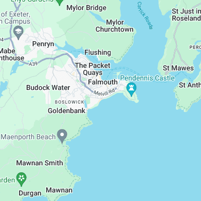
Surf spots nearby
- Maenporth (1.7 mi)
- Pendower (6.8 mi)
- Kennack Sands (10.4 mi)
- Gunwalloe (11.2 mi)
- Church Cove (11.5 mi)
- Poldhu Cove (11.5 mi)
- Caerhays (11.8 mi)
- Porthleven Pier (12 mi)
- Porthleven (12 mi)
- Chapel Porth (12.6 mi)
Not Magic Seaweed (MSW)
Although we look a bit like Magic Seaweed we are not MagicSeaweed as they no longer exist...