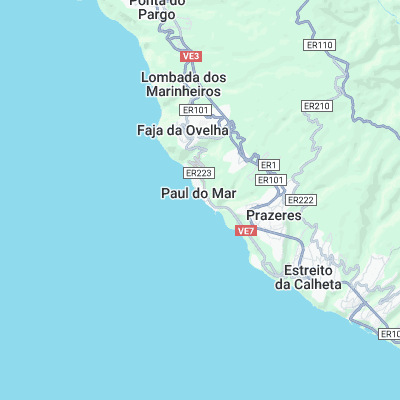
Paul do Mar (Paúl do Mar) Surf Report
| Wave height * | 2.5ft / 0.7m |
|---|---|
| Swell period | 12s |
| Swell direction | |
| Wind | |
| Sea temp | 20°C / 67°F |
10 day Paul do Mar surf forecast
Wed
1/May
2ft
6
2
9
- Low 3:33am
- High 9:53am
- Low 3:54pm
- High 10:11pm
Thu
2/May
2.5ft
2
9
5
- Low 4:47am
- High 11:03am
- Low 5:04pm
- High 11:17pm
Fri
3/May
3ft
6
8
5
- Low 5:44am
- High 11:58am
- Low 6:00pm
Sat
4/May
4ft
2
8
7
- High 12:11am
- Low 6:32am
- High 12:45pm
- Low 6:48pm
Sun
5/May
3.5ft
2
11
10
- High 1:00am
- Low 7:15am
- High 1:28pm
- Low 7:33pm
Mon
6/May
4ft
3
3
5
- High 1:44am
- Low 7:56am
- High 2:10pm
- Low 8:16pm
Tue
7/May
3.5ft
5
4
2
- High 2:28am
- Low 8:36am
- High 2:50pm
- Low 8:59pm
Wed
8/May
3.5ft
4
8
10
- High 3:10am
- Low 9:15am
- High 3:30pm
- Low 9:41pm
Thu
9/May
4.5ft
5
7
8
- High 3:53am
- Low 9:53am
- High 4:11pm
- Low 10:25pm
Fri
10/May
3ft
6
9
6
Wed 1st May
| 4:00 | 2ft | 4ft | 10s | 8mph (10mph) | |||
| 7:00 | 2ft | 4ft | 11s | 6mph (7mph) | |||
| 10:00 | 2ft | 4ft | 10s | 5mph (7mph) | |||
| 13:00 | 2ft | 4ft | 10s | 2mph (3mph) | |||
| 16:00 | 2.5ft | 4.1ft | 12s | 7mph (7mph) | |||
| 19:00 | 2.5ft | 4.2ft | 12s | 9mph (10mph) |
| Tide times |
|---|
| Low 3:33am (0.83m) |
| High 9:53am (1.80m) |
| Low 3:54pm (0.95m) |
| High 10:11pm (2.02m) |
| Daylight | |
|---|---|
| First light | 06:54 |
| Sunrise | 07:21 |
| Sunset | 20:50 |
| Dark | 21:17 |
Thu 2nd May
| 4:00 | 2.5ft | 4.7ft | 12s | 2mph (2mph) | |||
| 7:00 | 2.5ft | 4.9ft | 11s | 2mph (3mph) | |||
| 10:00 | 2.5ft | 5.1ft | 12s | 4mph (4mph) | |||
| 13:00 | 2.5ft | 5.1ft | 11s | 9mph (6mph) | |||
| 16:00 | 2.5ft | 4.9ft | 11s | 6mph (6mph) | |||
| 19:00 | 2.5ft | 4.8ft | 11s | 5mph (5mph) |
| Tide times |
|---|
| Low 4:47am (0.70m) |
| High 11:03am (1.94m) |
| Low 5:04pm (0.81m) |
| High 11:17pm (2.16m) |
| Daylight | |
|---|---|
| First light | 06:53 |
| Sunrise | 07:20 |
| Sunset | 20:51 |
| Dark | 21:17 |
Fri 3rd May
| 4:00 | 2.5ft | 4.5ft | 10s | 7mph (8mph) | |||
| 7:00 | 2.5ft | 4.5ft | 10s | 6mph (6mph) | |||
| 10:00 | 2.5ft | 4.6ft | 11s | 5mph (4mph) | |||
| 13:00 | 3ft | 4.6ft | 12s | 8mph (5mph) | |||
| 16:00 | 3ft | 4.6ft | 12s | 6mph (4mph) | |||
| 19:00 | 3ft | 4.6ft | 11s | 5mph (3mph) |
| Tide times |
|---|
| Low 5:44am (0.55m) |
| High 11:58am (2.10m) |
| Low 6:00pm (0.64m) |
| Daylight | |
|---|---|
| First light | 06:52 |
| Sunrise | 07:19 |
| Sunset | 20:52 |
| Dark | 21:18 |
Sat 4th May
| 4:00 | 3ft | 4.6ft | 10s | 2mph (1mph) | |||
| 7:00 | 3ft | 4.7ft | 10s | 2mph (3mph) | |||
| 10:00 | 3.5ft | 4.9ft | 10s | 4mph (2mph) | |||
| 13:00 | 4ft | 5.2ft | 10s | 8mph (5mph) | |||
| 16:00 | 3.5ft | 5.3ft | 11s | 9mph (6mph) | |||
| 19:00 | 3.5ft | 5.3ft | 10s | 7mph (6mph) |
| Tide times |
|---|
| High 12:11am (2.31m) |
| Low 6:32am (0.41m) |
| High 12:45pm (2.26m) |
| Low 6:48pm (0.49m) |
| Daylight | |
|---|---|
| First light | 06:51 |
| Sunrise | 07:18 |
| Sunset | 20:53 |
| Dark | 21:19 |
Sun 5th May
| 4:00 | 3.5ft | 4.9ft | 10s | 3mph (4mph) | |||
| 7:00 | 3ft | 4.7ft | 10s | 2mph (3mph) | |||
| 10:00 | 3ft | 4.6ft | 10s | 4mph (4mph) | |||
| 13:00 | 3.5ft | 4.6ft | 10s | 11mph (9mph) | |||
| 16:00 | 3.5ft | 4.6ft | 10s | 10mph (9mph) | |||
| 19:00 | 4ft | 4.8ft | 11s | 10mph (10mph) |
| Tide times |
|---|
| High 1:00am (2.42m) |
| Low 7:15am (0.31m) |
| High 1:28pm (2.38m) |
| Low 7:33pm (0.38m) |
| Daylight | |
|---|---|
| First light | 06:50 |
| Sunrise | 07:17 |
| Sunset | 20:53 |
| Dark | 21:20 |
Mon 6th May
| 4:00 | 4ft | 5ft | 10s | 3mph (4mph) | |||
| 7:00 | 4ft | 4.9ft | 10s | 3mph (4mph) | |||
| 10:00 | 4ft | 4.8ft | 10s | 1mph (3mph) | |||
| 13:00 | 4ft | 4.8ft | 10s | 3mph (3mph) | |||
| 16:00 | 4ft | 4.8ft | 10s | 3mph (4mph) | |||
| 19:00 | 3.5ft | 4.7ft | 10s | 5mph (5mph) |
| Tide times |
|---|
| High 1:44am (2.48m) |
| Low 7:56am (0.27m) |
| High 2:10pm (2.46m) |
| Low 8:16pm (0.32m) |
| Daylight | |
|---|---|
| First light | 06:49 |
| Sunrise | 07:16 |
| Sunset | 20:54 |
| Dark | 21:21 |
Tue 7th May
| 4:00 | 3.5ft | 5.2ft | 11s | 2mph (4mph) | |||
| 7:00 | 3.5ft | 5.4ft | 10s | 5mph (6mph) | |||
| 10:00 | 3.5ft | 5.3ft | 10s | 4mph (4mph) | |||
| 13:00 | 3.5ft | 5.3ft | 10s | 4mph (5mph) | |||
| 16:00 | 3.5ft | 5.2ft | 10s | 4mph (7mph) | |||
| 19:00 | 3.5ft | 5.2ft | 10s | 2mph (4mph) |
| Tide times |
|---|
| High 2:28am (2.47m) |
| Low 8:36am (0.28m) |
| High 2:50pm (2.48m) |
| Low 8:59pm (0.31m) |
| Daylight | |
|---|---|
| First light | 06:49 |
| Sunrise | 07:15 |
| Sunset | 20:55 |
| Dark | 21:21 |
Wed 8th May
| 4:00 | 3.5ft | 5.2ft | 13s | 3mph (4mph) | |||
| 7:00 | 3.5ft | 5.4ft | 13s | 4mph (4mph) | |||
| 10:00 | 3.5ft | 5.4ft | 13s | 6mph (6mph) | |||
| 13:00 | 3.5ft | 5.5ft | 13s | 8mph (8mph) | |||
| 16:00 | 3.5ft | 5.3ft | 13s | 9mph (9mph) | |||
| 19:00 | 3ft | 5.1ft | 12s | 10mph (11mph) |
| Tide times |
|---|
| High 3:10am (2.41m) |
| Low 9:15am (0.36m) |
| High 3:30pm (2.45m) |
| Low 9:41pm (0.37m) |
| Daylight | |
|---|---|
| First light | 06:48 |
| Sunrise | 07:14 |
| Sunset | 20:55 |
| Dark | 21:22 |
Thu 9th May
| 4:00 | 3.5ft | 5.3ft | 12s | 2mph (2mph) | |||
| 7:00 | 3.5ft | 5.4ft | 9s | 5mph (6mph) | |||
| 10:00 | 4ft | 5.5ft | 9s | 4mph (5mph) | |||
| 13:00 | 4.5ft | 5.5ft | 8s | 7mph (7mph) | |||
| 16:00 | 3.5ft | 5.4ft | 8s | 6mph (8mph) | |||
| 19:00 | 2.5ft | 5.3ft | 8s | 8mph (9mph) |
| Tide times |
|---|
| High 3:53am (2.29m) |
| Low 9:53am (0.47m) |
| High 4:11pm (2.38m) |
| Low 10:25pm (0.47m) |
| Daylight | |
|---|---|
| First light | 06:47 |
| Sunrise | 07:13 |
| Sunset | 20:56 |
| Dark | 21:23 |
Fri 10th May
| 4:00 | 2.5ft | 5ft | 8s | 6mph (6mph) | |||
| 7:00 | 2.5ft | 5.1ft | 8s | 6mph (6mph) | |||
| 10:00 | 2.5ft | 5.2ft | 9s | 6mph (6mph) | |||
| 13:00 | 3ft | 5.2ft | 9s | 9mph (8mph) | |||
| 16:00 | 2.5ft | 5.2ft | 9s | 4mph (6mph) | |||
| 19:00 | 2.5ft | 5.1ft | 9s | 6mph (6mph) |
| Tide times |
|---|
| Daylight | |
|---|---|
| First light | 06:46 |
| Sunrise | 07:13 |
| Sunset | 20:57 |
| Dark | 21:24 |
Consistent break over flat boulder reef situated in front of the town. Set up varies according to swell but it is always powerful and usually treacherously shallow at low tide
Surf spots nearby
- Jardim do Mar (0.1 mi)
- Ponta Pequena (1.7 mi)
- Ponta do Tristao (8.3 mi)
- Faja da Aeria (11.7 mi)
Not Magic Seaweed (MSW)
Although we look a bit like Magic Seaweed we are not MagicSeaweed as they no longer exist...